The Bill's Map Projections program
About the Program
The program was written by me in Visual Basic. It originally started as a VB6 program that I wrote back in 2008. This version has been much cleaned up and is presentable enough that I am happy to offer it for download should anyone wish to use it.
My requirements for the tool were as follows:
- Create azimuthal equal area or equidistant plots
- These plots to be centered around any selected city or location
- Other cities should be plotted on the map as well
- Have the ability to change the base map
- To be fast enough such that there was no frustrating waiting
New in Version 2 is the option to display latidude and longitude lines, and lots more user selectable options for how the annotations are displayed.
The Interface
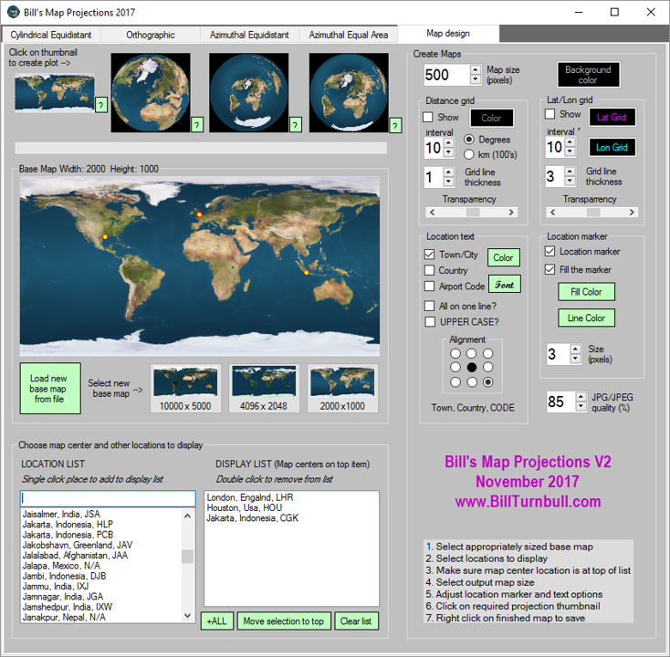 |
Using the tool
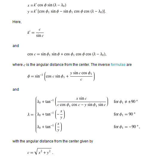
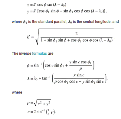
The equations
A form of conformal transformation is required to convert between latitude and longitude and the coordinate system required to plot these projections. The equations required to do the transforms are described succinctly on the Wolfram MathWorld website. Screen captures of the Wolfram summaries are shown below:
Azimuthal Equal Area:
Azimuthal Equidistant: